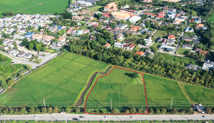
Understanding Your Plot Plan – What Area(s) You Can Develop
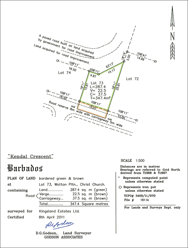
Whenever you purchase a house, or parcel of land, one of the key documents required for the transaction will be the plot plan. This is a scaled drawing of your lot, using a bird’s eye view, which outlines the property’s boundaries, any known encroachments, and the land area. A plot plan is usually prepared by a Certified Land Surveyor. When reviewing the plan you may note a few different numbers as shown on the example – but what do all the numbers actually mean? While not exhaustive, we’ve broken down below, the main areas most often denoted on a plot plan, and what they mean for you the property owner.
LAND
This Is All Yours
Also called the “net land area”, this is private property and refers to the net useable area of land which can be developed. When property valuers review a plot plan they either consider the “Land” measurement only or “Land” + “Verge” where applicable.

VERGE
Private Property
The verge is the strip of land between the roadside and the fence, hedge or wall of the private property immediately next to it. This area still forms part of the owner’s property as hedges, driveways and pedestrian paths can be developed on this but not structures.
CARRIAGEWAY
Part of The Road
A carriageway is the portion of road on which a vehicle is not restricted from the sideway movement by any physical barriers. Simply put, it is the part of the road intended solely for vehicles rather than pedestrians. When a plot plan depicts an area of carriageway, this area cannot be used for development and is often excluded by property valuers in their analysis.

ROAD
Just What It Says
The road measurement is the area between the centre line of the road, and the boundary of the private property. This is part of the road, and can never be developed by the land owner. Even though this area is included in the gross land area it is technically “public property ” and is typically excluded by property valuers in their analysis.
OTHER POINTS TO NOTE
Not All Plans Are The Same
A plot plan is not the same as a site plan. While the plot plan focuses specifically on the individual parcel of land, its boundaries, etc. a site plan denotes the placement of all the structures proposed to be developed on the site. It can also show where the selected plot is located in relation to known geographical landmarks such as highways, churches, the sea, main towns, etc. Also note that plot plans must be periodically updated (usually every 20 years), as development may have occurred during that time which could impact the useable area e.g. roads and highways.


Thank you for this information, it was very useful.
Thank you for this information, it was very useful.